Google Maps has always helped you get from place to place, whether you’re driving, walking, biking or taking public transit. And we know that transit journeys can be complex–often involving multiple modes of transportation to help you get around town. But don’t worry, Google is making it easy to pair transit directions with biking and ridesharing options like online taxi and ojek, so you can travel that first or last mile with ease.
Say you’re taking the MRT Jakarta home from a friend’s house, but your apartment is a bit too far from the station to get to on foot. Catching a ridesharing vehicle can help you travel that short distance quickly. Or, you’re headed to work at the peak time so you need to ride your bike to the nearest bus stop to make that important meeting on time. Reporting from Google Blog, here's the easy way.
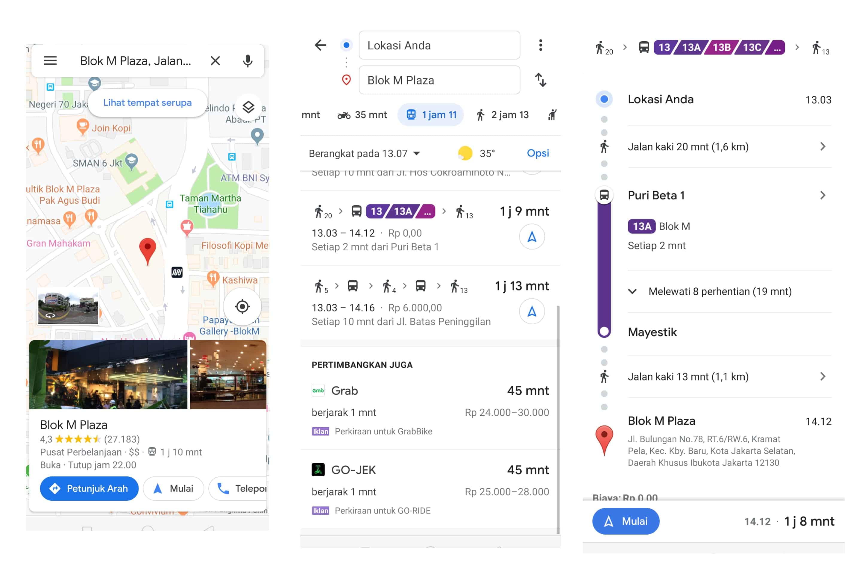
Enter your destination in the search box, tap on “Directions” and then on the transit tab. From there, you’ll automatically see routes that feature ridesharing and cycling options paired with transit directions. If you’re taking a ridesharing vehicle, you’ll see helpful information about each leg of your trip: how much your ride will cost, how long the wait is, if there’s traffic on your ride, and when your bus or train departs. You can also choose your favorite rideshare provider.
If you’re biking, then you’ll see routes tailored for cyclists along with everything you need to know about the transit portion of your journey. All of this information is automatically factored into your total travel time and ETA (Estimate Time of Arrival), so you can know exactly when you’ll get to your destination.